
ROAD TRIPPING SWITZERLAND: 7 DAYS OF EPIC VIEWS AND ADVENTUROUS HIKES
One of the most Insta-worthy countries in all of Europe would definitely be Switzerland, so it’s not surprising the country gets almost 12 million visitors each year. With its vast mountain ranges, deep valleys and beautiful lakes, it’s impossible to ever get bored. Maybe you’ve been there before, skiing or hiking in the summer, but have you ever considered doing a road trip in Switzerland? Well, this one will take you to the most stunning views in all of the country!
Why should you do a Switzerland road trip in the first place?
Switzerland is home to some of the most amazing views of Europe. The country has 48 mountains over 4000 meters, is home to the longest glacier in Europe and of course some of the best chocolate. There is just so much to see and so little time to do so that a road trip is perfect to make the most out of your time in Switzerland. This road trip is the perfect combination of seeing as many beautiful places and not spending hours on end in your car!
What is the best time to travel to Switzerland?
Switzerland can get really touristy in the summer months, so the best month considering both that and the weather is actually June. The downside of the month of June is that the majority of the mountain lifts and huts aren’t opened yet so you’d have to walk everywhere. Another upside is that the prices of the accommodations are still on the lower side compared to the high season in July and August. The same goes for september: the climate is still moderate, there are way less tourists and prices are lower, but cable cars and other tourist attractions might already be closed for the season.
Day 1 - Montreux
Driving time from Geneva Airport: 60 minutes
Montreux is a small city on the shores of Lake Geneva and it feels a little like the French Riviera with lush vineyards covering the surrounding mountain flanks and temperatures often rising into the high twenties in summer. The city is famous for its colourful flowers that cover the boulevards from June to September and it’s the perfect place to start a road trip. You can visit the different castles that surround the city or go for a stroll next to the lake. The center is full of stores and small boutiques for shopping and there are plenty of places to rent out a boat to enjoy an afternoon on the lake.
The best places to park in Montreux you can find here: https://www.parking.ch/de/parkings/montreux

Day 2 - Verbier
Driving time from Montreux: 60 minutes
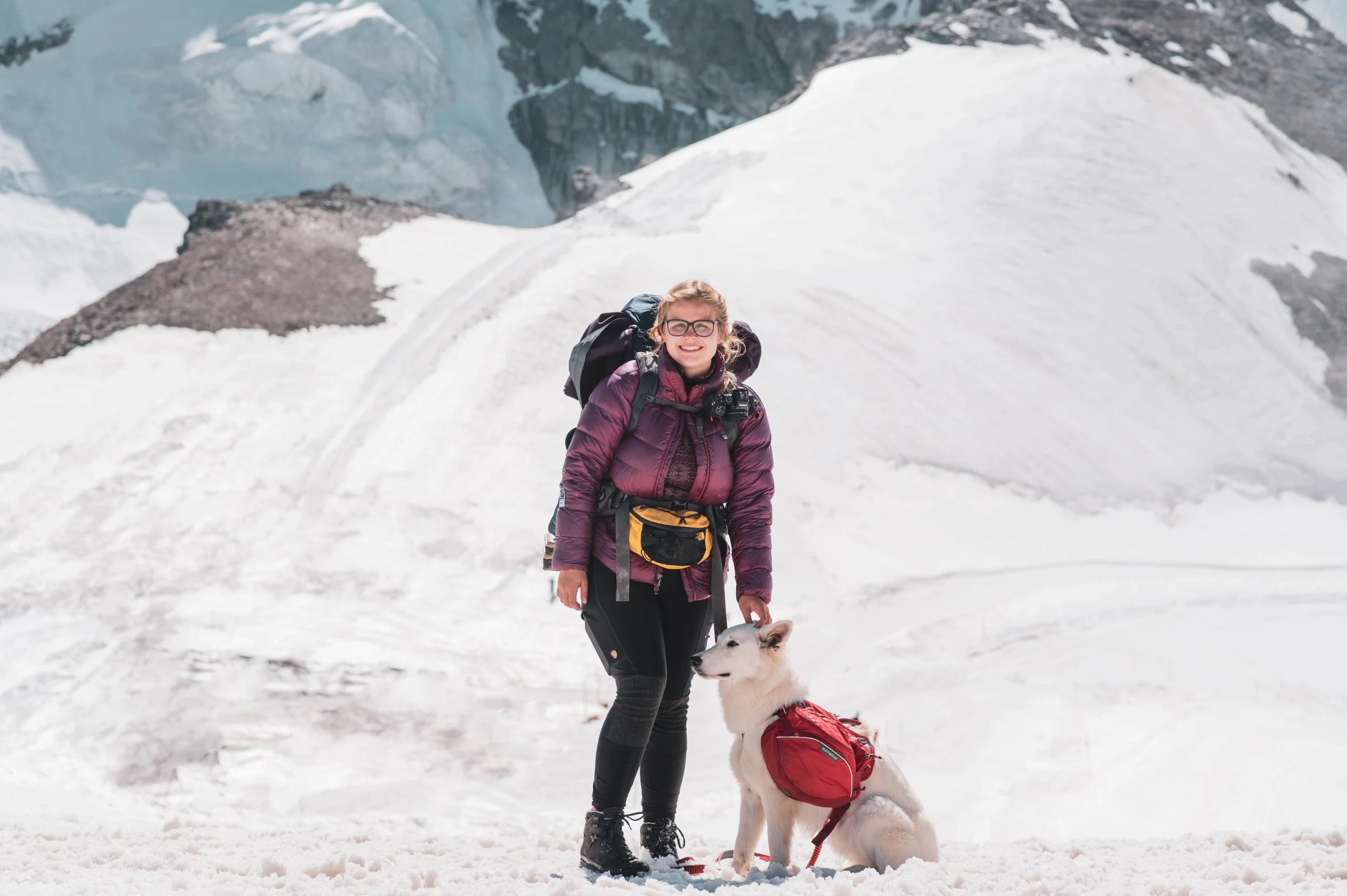
Verbier is mostly known for its wintersports - one of the places to be in winter. But in summer it is definitely equally beautiful. Since it was on our route and I’d been there before when I was younger, we decided this was the second stop we would make on our roadtrip. There are more hiking routes than you would ever be able to do even during a week’s stay and they all have stunning views over the Swiss mountains. Because of the time constraint we had, we decided to take the cable car up to Mont Fort, one of the most beautiful viewpoints I’ve ever seen in my life. You have to take about four different cable cars to get there and cover a very a big distance. Definitely bring a coat and even gloves, because Mont Fort is, with its 3328 meters, one of the highest mountains there, so you’ll get high winds guaranteed, but the view is definitely worth it. On a good day you’ll see the Matterhorn, the Mont Blanc and even some of the mountains of Berner Oberland! We took one cable car back down afterwards, then hiked further down, until we got to the last cable car to get back to Verbier/
We didn’t drive up to Verbier itself, but instead parked in the big parking lot in the main valley, from where you can take a cable car up into the valley itself. If you’re planning to take multiple cable cars to get around, it’s best to buy an all access pass for one day, which will cost you about 20 Swiss Francs per person.
When you want to have lunch or dinner in the city center, beware that some of the restaurants are extremely expensive. We ate in Osteria La Nonna, which I wouldn’t recommend at all since there wasn’t much choice and we definitely paid too much for what we got.


Day 3 - Cabane de Dix
Driving time from Verbier: 1 hour 45 minutes
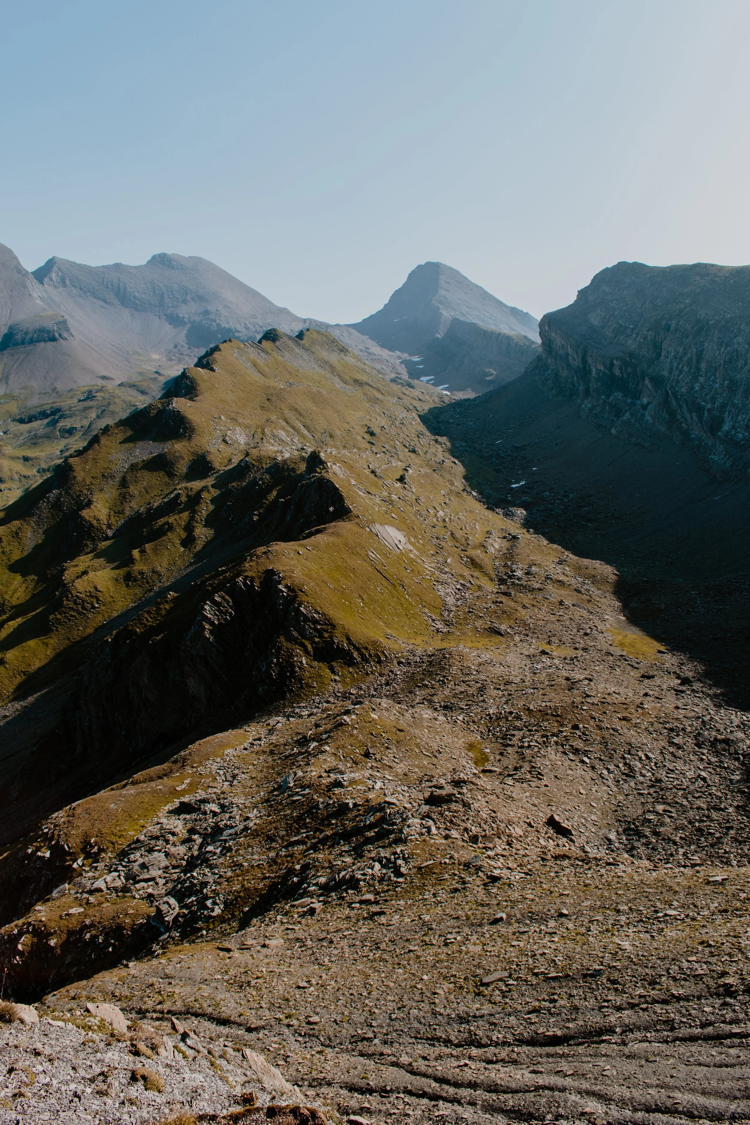
A little less known is Cabane de Dix, situated right above the lake with the same name. Of all of the cabins I’ve been to in Switzerland (and that’s a lot), this one is the best combination of epic views and rather easy to get to, without it being completely overrun by tourists. From Sion, you’ll drive up this picturesque valley dotted with small villages until you reach the big parking lot below the lake (which is actually a gigantic reservoir. From there, you can hike up to it via a big road or skip those first 150 vertical meters by taking a cable car. Whichever one you choose, the vistas are immediately incredible. White capped mountains as far as the eye can reach and an turquoise lake right beneath them, surrounded by evergreen pastures. The trail leads you along the lake and when you reach the other side, it starts going up. Now remember I said the perfect combination of views and easy to reach? The path leading up to Cabane the Dix is rather easy, but you still have to make it 600 vertical meters up so definitely take plenty of time for this hike. But once you reach the mountain hut, you’ll see that the climb was a 100% worth it. Enjoy some good food and a cold drink on the terrace and just take in the panorama that enfolds before you.
I do recommend staying the night here if you love sunsets and sunrises (I mean, who doesn’t?) because those are just stunning. Mountain huts usually offer a combination of private rooms and big dormitories, with half board. Do mind that if you want to stay during the weekends, you’ll have to book a couple of months in advance. Locals like to go up into the mountains during the weekends to go climbing, so those days are the busiest. And if you rather spend the night in your van or a nice hotel, it is perfectly possible to do this trip as a dayhike! Do mind the opening times of the cable cars if you plan on taking those. You can download the route in GPX format down below!

Day 4 - Zermatt
Driving time from Lac de Dix: 1 hour 47 minutes
Zermatt is maybe the most famous place in all of Switzerland. Have you ever eaten Toblerone Chocolate? Well, then you have seen the village’s biggest feature: the Matterhorn. Its name itself is already suggestive: horn of the meadows. It’s the mountain we drew when we were three years old. But despite the Matterhorn being the most famous feature (and by famous I mean Asian people taking pictures of the clouds where the mountain “should be” on a not cloudy day after asking where it was - true story lol), Zermatt is a stunning destination for so many more reasons than just that single mountain.
The village of Zermatt itself is a real mountain town, where each well known outdoor brand has their own store. It’s buzzing with alpinists, hikers, tourists in Prada shoes and locals all at the same time, creating this amazing atmosphere where everybody has a place. The entire village is also car-free, making it a joy to just stroll along the streets laced with traditional wooden houses and cosy restaurants.
And of course, apart from the village itself, Zermatt is home to one of the most amazing mountain sceneries in all of Europe, maybe the world. A dozen cable cars and railways take you up into the mountains with 360 degree views at all times. Here are a couple of places I’d recommend visiting (besides the classics you’ll find the internet plastered with):
The Gandegg Hütte: a very yellow mountain hut situated at 3030 meters above sea level. If there is one hut where you would want to stay to see the sunset, it is definitely this one. They also make a mean spaghetti arrabiata. The Gandegg Hütte is reachable on foot from Zermatt (Download the GPX down below) or you can take the cable car up to Trockener Steg and hike the last hundred meters up from there.
Pfulwe Pass: you want the most amazing view on the Monte Rosa mountains, including the Matterhorn, in all of the Zermatt-area? And you want to be there alone, no crowds? Well, then this one is for you. You can reach Pfulwe pass from two sides. You can hike up from Täsch to Täschalp (or take a minibus, leaving from the tourist office). There is a marked mountain trail leading up the remote valley, through rocks and boulders and even some snow fields up the back of the mountains until you arrive at the pass. Do note that this side is still considered a blue mountain path or a T4, making it officially an alpine route. Do not attempt this route unless you have sufficient experience. The other trail is way easier and definitely not less beautiful. You either choose to hike up to or take a cable car to Sunegga from the village from Zermatt. From there a beautiful, easy mountain trail leads up to Flualp, where you can enjoy a very tasty omelet. Behind the hut, the trail keeps climbing next to the famous Gorner Glacier (it’s literally the only trail there) until you reach Pfulwe pass. This is literally the most gorgeous view of all of the valley you can get and you’ll probably be pretty much alone since this is a rather unknown trail.
Walk on Mars: or at least, that’s what I call this hike. It really looked like some foreign planet when we were hiking this trail. From Trockener Steg, you can hike all the way to the Schwarzsee. For this hike you can again either choose to go up by cable car from Zermatt or go on foot. From Trockener Steg, a trail leads you to over former glacial terrail, covered in big boulders and laced with tiny lakes. This trail is also perfect if you want to learn a thing or two about glaciers and is also perfectly doable with kids. Right before you reach the Schwarzsee you can also opt to do a little sidetour up to the Hornli Hütte, from where climbers start their climb of the Matterhorn. At the Schwarzsee, you have to opportunity to get some food or take a cable car down.
When traveling to Zermatt, you’ll have to leave behind your car in the parking lot of Täsch and take a train so look up the train schedule beforehand. There are trains going up every twenty minutes.


Day 5 - Saas-Fee
Driving time from Zermatt: 45 minutes
Still staying among the highest mountains of Switzerland, Saas-Fee is situated in the valley next to Zermatt and also a car-free village. You can park your car at the edge of the village. We parked our van right below the big parking garage, with a beautiful view of the mountains (you’re allowed to camp here, but there are no amenities like water, electricity or a toilet. Saas-Fee is definitely not as well known as Zermatt, but I found it to be a very nice place to hang out. The best coffee and hot chocolate you can find at 12-Inch-CofFee. They also have a very comfy yard to lounge in.
The - in my opinion - best thing to do in Saas-Fee is taking the cable car and train up to Spielboden and Längfluh to see the vast glacier underneath the Allalinhorn. This is also a great place for some summer skiing. On the way back, you can hike down from Spielboden (or hike both up and down to save some money, because this cable car will cost you about 70 Swiss Francs round trip).
Another amazing hike starts from Saas-Grund, the village below Saas-Fee. You take the cable car all the way up to 3142m where you’ll find the 1,2 km Eighteen 4,000-Metre Peaks Trail. The name itself says it all: the trail offers an amazing view of in total 18 peaks over 4000 meters. This is the trail that made me fall in love with mountains when I was 17 years old. Up until today, I still don’t know why, but the utter vastness of the mountains that surrounded me on that trail just touched me in my core, and it has never let go of me since. This trail is also very doable with kids and it is well indicated. You can find out more about this trail here: https://www.outdooractive.com/en/route/nature-trail/saas-grund/eighteen-4-000-metre-peaks-trail/23425808/ .


Day 6 - Oeschinensee
Driving time from Saas-Fee: 1 hour 27 minutes
A very Instagram famous spot in the Swiss Alps is the Oeschinensee. It’s perked between the steep walls of the mountains above the village of Kandersteg. The fastest way to get to Kandersteg from the area of Saas-Fee and Zermatt is to drive up to Goppenstein, where you drive your car up on a train, which will take you through a tunnel, right into Kandersteg. You can park your car at the parking lot near the cable car. You can again choose to hike up to the lake or take the lifts (which cost you about 30 Swiss Francs for a round trip). We originally opted to take the cable cars up, so we could hike a trail to one of the huts that lay high above the lake, but once we got there, the weather took a turn for the worse and we ended up staying at the lakeside hotel, which was also a very nice experience.

Day 7 - Grindelwald
Driving time from Grindelwald: 1 hour 3 minutes
Next to Zermatt one of the most famous - and most touristy - places of Switzerland is Grindelwald. Famous for the highest trainstation in Europe, the Jungfrau Joch and infamous for the treacherous Eiger North Wand, that has killed many that have attempted to climb it. The village itself does not have the charm of Zermatt, but the surrounding mountains definitely can compete with the views. Here are three of my favourite hikes in the area:
The Eiger Trail: a well known and easily accessible trail is the Eiger trail. It starts from the Eiger Glacier train station and brings you all the way back down to Grindelwald. You can reach the Eiger Glacier train station by train from Grindelwald, or you can take the cable cars up. From there, the trail runs right underneath the Eiger North Wand, which is really impressive to see so close up. GPX down below.
The Bachalpsee: a very short trail, but one of the Alps’ mirror lakes lies at the end, so it’s definitely worth a visit. From the top of First, the cable cars from Grindelwald, it’s only about 45 minutes depending on your pace. If you go early in the morning, chances of less wind and thus a beautiful mirror view are the greatest (and later in the day the place is just crawling with tourists). The best view on the lake you get when you hike up slightly higher!
Around the Schwarzhorn: this trail is a little more involved and definitely less known, but very beautiful. You start off at the top station of the First cable cars and hike to the Bachalpsee. From there, you start hiking up and over a small pass, so you end up on the back side of the mountain, where you’ll probably be alone, away from the tourists. You just keep following the only trail there is up and down, until you reach Grosse Scheidegg. There you can choose to hike down to Grindelwald, or back to First to take the cable cars down. If you’re in great physical condition, you can also climb the Schwarzhorn itself (but be aware that this is not an easy mountain to climb, with a klettersteig on one side and an alpine path (T4) on the other. GPX down below.


So, there you have it: the perfect 7-day road trip through Switzerland. You can easily add a few days onto it or even leave out some places if you don’t have seven days to spare. Where are you most excited to go first? Let me know in the comments below and definitely let me know if you found this useful!